
Most Popular


-
6
Actor’s excessive airport security sparks probe into human rights violations

-
7
Crowded public transport, long commutes top stressors for Seoul, Gyeonggi workers: survey

-
8
Man who let his father die due to financial difficulties to be released on parole

-
9
Actor Yoo Ah-in accused of sexual attack

-
10
S. Korea, China shifting from tensions to cooperation: Seoul


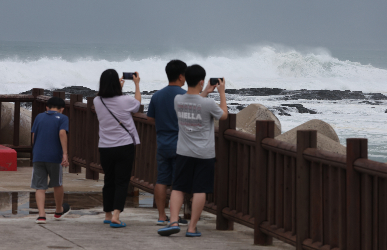
Korea is bracing for typhoon Hinnamnor, which is expected to be one of the strongest typhoons to hit the country.
It is a “super strong” typhoon, the highest in Korea's four-tier system, with an atmospheric pressure of 920 hectopascals at its center and a maximum wind speed of 54 meters per second.
According to the Korea Meteorological Administration, Korea's Jeju Island and southern regions are expected to come under influence of Hinnamnor starting Monday. The typhoon is expected to hit the southern port city of Busan on Tuesday.
President Yoon Suk-yeol on Sunday held an emergency meeting in response to the approaching typhoon. Yoon ordered the interior minister to make full preparations for the typhoon, including the preemptive operation of the Central Disaster and Safety Countermeasure Headquarters the day before.
"The worries are grave as Typhoon Hinnamnor is approaching Korea, though the damages from the heavy rainfall (last month) have yet to be recovered," presidential spokesperson Kang In-sun said through a written briefing on behalf of Yoon.
"Disasters hit especially hard on those who are socially disadvantaged. We should do our best to minimize the damages of the typhoon and put the people’s safety as our priority."
Last month, Yoon came under fire for overseeing the disaster from his home during the massive flooding in Seoul and its surrounding regions. The opposition party attacked Yoon's administration for the lack of a command center.
As for the approaching typhoon, the Korea Meteorological Administration forecasts that it will be 460 kilometers southwest of Jeju Island by Monday at 9 a.m. The typhoon is expected to weaken as it approaches the peninsula, dropping to the second-strongest level when reaching the waters 180 kilometers southwest of Jeju Island. However, it is expected to develop into a stronger typhoon when it lands 20 kilometers northwest of Busan at Tuesday 9 a.m. with an atmospheric pressure of 950 hPa at its center and a maximum wind speed of 43 m/s.
Forecasters have warned that it could be as strong as Typhoon Maemi in 2003. The disaster left 117 dead, 13 missing and wreaked damages worth over 4 trillion won ($2.9 billion).
Typhoon Hinnamnor was traveling northward at a speed of 18 kilometers per hour over the waters northeast of Taipei, Taiwan, as of Sunday. It sped up significantly from its previous speed of 11 kph recorded the day before.
As a result of the approaching typhoon, most parts of Korea were lashed with heavy rain on Sunday, with Jeju Island seeing up to 273.5 millimeters of rain on Hallasan.
Between 100 and 300 mm of rain is expected to fall from Sunday to Tuesday, with the mountainous areas of Jeju receiving more than 600 mm of rain.
Preliminary weather advisories have been issued in the southern parts of Korea, including the cities of Gwangju, Busan, Daegu and Ulsan. An advisory was issued for Jeju Island a day before.
Meanwhile, Prime Minister Han Duck-soo has called for schools to shut down or switch to online classes as a safety precaution until Tuesday.
The country is expected to be under the influence of the typhoon through Wednesday.
By Im Eun-byel (silverstar@heraldcorp.com)


![[Today’s K-pop] Treasure to publish magazine for debut anniversary](http://res.heraldm.com/phpwas/restmb_idxmake.php?idx=642&simg=/content/image/2024/07/26/20240726050551_0.jpg&u=)