Most Popular
-
1
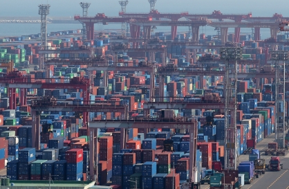
Exports to US reach all-time high, widen gap with China
-
2
Trump rekindles criticism: US forces defending 'wealthy' S. Korea 'free of charge'

-
3
[Music in drama] Rekindle a love that slipped through your fingers
![[Music in drama] Rekindle a love that slipped through your fingers](//res.heraldm.com/phpwas/restmb_idxmake.php?idx=644&simg=/content/image/2024/05/01/20240501050484_0.jpg&u=20240501151646)
-
4
S. Korea discussed possible participation in AUKUS Pillar 2 with Australia: defense minister

-
5
[New faces of Assembly] Architect behind ‘audacious initiative’ believes in denuclearized North Korea
![[New faces of Assembly] Architect behind ‘audacious initiative’ believes in denuclearized North Korea](//res.heraldm.com/phpwas/restmb_idxmake.php?idx=644&simg=/content/image/2024/05/01/20240501050627_0.jpg&u=20240502093000)


![[Music in drama] Rekindle a love that slipped through your fingers](http://res.heraldm.com/phpwas/restmb_idxmake.php?idx=644&simg=/content/image/2024/05/01/20240501050484_0.jpg&u=20240501151646)

![[New faces of Assembly] Architect behind ‘audacious initiative’ believes in denuclearized North Korea](http://res.heraldm.com/phpwas/restmb_idxmake.php?idx=644&simg=/content/image/2024/05/01/20240501050627_0.jpg&u=20240502093000)
-
6
On May Day, labor unions blast Yoon's foreign nanny proposal

-
7
Seoul Metro to seek legal action against malicious complaints
-
8
[KH Explains] Will alternative trading platform shake up Korean stock market?
![[KH Explains] Will alternative trading platform shake up Korean stock market?](//res.heraldm.com/phpwas/restmb_idxmake.php?idx=644&simg=/content/image/2024/05/01/20240501050557_0.jpg&u=20240501161906)
-
9
Illit, mired in controversy, remains on Billboard charts for 5th week

-
10
S. Korea lowers COVID-19 warning level, lifts last-remaining antivirus mandates


![[KH Explains] Will alternative trading platform shake up Korean stock market?](http://res.heraldm.com/phpwas/restmb_idxmake.php?idx=644&simg=/content/image/2024/05/01/20240501050557_0.jpg&u=20240501161906)


The city of Mildura is not at the end of a dirt road in the Australian bush, in tire-choking desert sand far from food and water. Unfortunately, Apple‘s much-maligned mapping application thinks it is.
More than two months after Apple’s CEO apologized for errors in its Maps service, Australian police say the app is ``potentially life threatening‘’ because of the bad directions it has given to the southern city. On Tuesday, a police official said Apple had ``sort of half-fixed‘’ the problem.
Victoria state police say they‘ve had to rescue several Mildura-bound drivers who were directed by the app to remote Murray Sunset National Park, about 70 kilometers (44 miles) away. Some were stranded for 24 hours without food or water, and had to walk long distances through tough terrain to access phone reception.
``Police are extremely concerned as there is no water supply within the park and temperatures can reach as high as 46 degrees (115 degrees Fahrenheit), making this a potentially life threatening issue,’‘ police said in a statement.
The 5,000-square-kilometer (1,900-square-mile) park has desert-like conditions, scorching temperatures and virtually no mobile phone reception.
In the past 30 days, six people have been stranded after turning into the park via a dirt road the Maps application recommends, Mildura police inspector Simon Clemence said. Some were able to get out on their own but others needed to be rescued by police, he said.
The track eventually opens up into rough desert terrain that is accessible only to 4-wheel-drive vehicles. That’s where cars are getting stuck in the sand, Clemence said.
``If you‘re stuck out there in that you haven’t prepared, you‘ve got nothing, you could be in a fair bit of trouble,’‘ he said.
Earlier this year, Apple dropped Google Maps from its mobile operating systems in favor of its own mapping application, which was quickly and widely criticized for bad directions, misplaced landmarks and missing towns. Apple CEO Tim Cook apologized for the mapping service in September and promised to improve it.
``We screwed up and we are putting the weight of the company behind correcting it,’‘ Cook said in an interview aired Thursday on NBC’s ``Rock Center.‘’
Apple spokeswoman Fiona Martin declined to comment Tuesday, and referred The Associated Press to Cook‘s apology.
Clemence said police received no response when they tried to contact Apple, but that on Tuesday morning _ a day after police went public with the problem _ it appeared that the company had tried to fix it.
Drivers coming from the southern city of Adelaide are now correctly directed by the Maps application to Mildura, Clemence said. But drivers from Melbourne are still sent into the park.
``So 50 percent of the people are safe and 50 percent of the people aren’t,‘’ Clemence said with a chuckle. ``So they sort of half-fixed it.‘’
With temperatures this week expected to soar in the region, Clemence said it‘s critical that the directions are corrected quickly.
``It’s a pretty serious problem,‘’ Clemence said. ``There‘s a fair amount of responsibility on Apple to get this fixed.’‘ (AP)
<관련 한글 기사>
‘i고립’ 믿었던 애플 지도 “생명 위협 할 수 있다”
애플 아이폰5에 탑재된 지도 서비스에 대한 ‘경계령’이 떨어졌다.
NBC 등 미국과 호주 언론은 애플 지도로 인해 호주에서 수많은 운전자들이 야생지대에 고립되는 등의 극심한 피해를 겪고 있다며 호주 경찰이 애플 지도 사용을 주의하라는 경고를 내렸다고 11일(한국시간) 보도했다.
매체들에 따르면 최근 많은 운전자들이 애플 아이폰5에 탑재된 잘못된 지도로 머레이 선셋 국립공원 한가운데 갇혀 물과 음식 없이 24시간을 버티다 겨우 경찰에 구조됐다.
호주 빅토리아주 북서쪽에 있는 머레이 선셋 국립공원은 사람의 손길을 최소화해 자연환경이 잘 보존되어 있는 대표적인 공원이다. 하지만 야생 동물과 독을 가진 뱀과 곤충이 득실대고 영상 46도에 달하는 고온으로 인해 고립될 경우 생명이 위태로울 수 있다.
사우스이스트 빅토리아주 경찰 측은 “고립된 운전자들은 아이폰5 지도만 믿고 가다가 갑자기 뱀과 여우, 염소를 만나 기겁해 차 밖으로 빠져나오지 못했다”며 “이는 잠재적으로 생명을 위협하는 문제”라고 말했다. 경찰 조사 결과 애플 지도에는 ‘밀두라’라는 관광타운의 지명이 실제 위치에서 무려 43마일(약 70km)이나 떨어진 머레이 선셋 국립공원 한복판으로 입력돼 있었다고 밝혔다.
빅토리아 경찰은 애플에 결함 수정을 요청하는 공문을 보냈지만 여전히 애플의 지도는 변하지 않고 있다. 애플은 기존의 구글맵을 버리고 아이폰5에 애플맵을 탑재했지만 오류가 많아 전세계 사용자들의 불만이 폭증하고 있다. (헤럴드생생뉴스)