
Most Popular
-
1
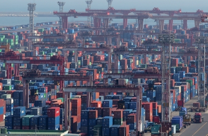
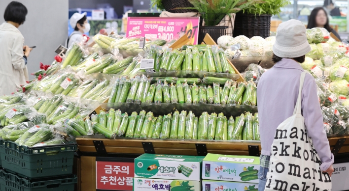
Exports to US reach all-time high, widen gap with China
-
2
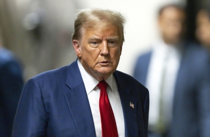
Trump rekindles criticism: US forces defending 'wealthy' S. Korea 'free of charge'
-
3
[Music in drama] Rekindle a love that slipped through your fingers
![[Music in drama] Rekindle a love that slipped through your fingers](//res.heraldm.com/phpwas/restmb_idxmake.php?idx=644&simg=/content/image/2024/05/01/20240501050484_0.jpg&u=20240501151646)
-
4
S. Korea discussed possible participation in AUKUS Pillar 2 with Australia: defense minister
-
5
[New faces of Assembly] Architect behind ‘audacious initiative’ believes in denuclearized North Korea
![[New faces of Assembly] Architect behind ‘audacious initiative’ believes in denuclearized North Korea](//res.heraldm.com/phpwas/restmb_idxmake.php?idx=644&simg=/content/image/2024/05/01/20240501050627_0.jpg&u=20240502093000)


![[Music in drama] Rekindle a love that slipped through your fingers](http://res.heraldm.com/phpwas/restmb_idxmake.php?idx=644&simg=/content/image/2024/05/01/20240501050484_0.jpg&u=20240501151646)

![[New faces of Assembly] Architect behind ‘audacious initiative’ believes in denuclearized North Korea](http://res.heraldm.com/phpwas/restmb_idxmake.php?idx=644&simg=/content/image/2024/05/01/20240501050627_0.jpg&u=20240502093000)
-
6
Seoul Metro to seek legal action against malicious complaints
-
7
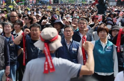
On May Day, labor unions blast Yoon's foreign nanny proposal
-
8
Illit, mired in controversy, remains on Billboard charts for 5th week

-
9
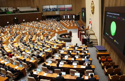
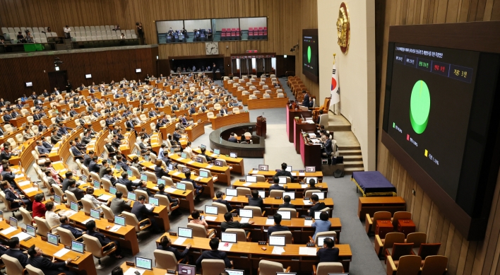
Opposition-led Assembly unilaterally passes bill to probe Marine's death
-
10
[KH Explains] Will alternative trading platform shake up Korean stock market?
![[KH Explains] Will alternative trading platform shake up Korean stock market?](//res.heraldm.com/phpwas/restmb_idxmake.php?idx=644&simg=/content/image/2024/05/01/20240501050557_0.jpg&u=20240501161906)


![[KH Explains] Will alternative trading platform shake up Korean stock market?](http://res.heraldm.com/phpwas/restmb_idxmake.php?idx=644&simg=/content/image/2024/05/01/20240501050557_0.jpg&u=20240501161906)

Korea renames Dokdo peaks to symbolize sovereignty
By Korea HeraldPublished : Oct. 28, 2012 - 20:15
Dokdo, which lies closer to South Korea in the body of water between the Korean Peninsula and Japan, has long been a thorn in relations between the two countries. South Korea keeps a small police detachment on the islets ― consisting mainly of Dongdo and Seodo ― effectively controlling them.
According to the Ministry of Land, Transport and Maritime Affairs, the government has decided to rename Dongdo “Usanbong” and Seodo “Daehanbong,” and use the new names starting Monday in the country’s official maps, textbooks and Internet portals.
The reason why the government selected “Usanbong” as the official name for Dongdo is based on historical records. Dokdo itself used to be called “Usando” during the Joseon Dynasty (1392-1910).
The name “Daehanbong” for Seodo, meanwhile, is based on the country’s name in Korean, emphasizing that Dokdo is part of South Korean territory, the ministry said.
The move comes amid lingering tension over Dokdo since President Lee Myung-bak made a surprise and unprecedented trip to the islets in August, touching off a diplomatic feud between the two neighboring countries.
South Korea regained independence after Japan’s 1910-45 colonial rule and reclaimed sovereignty over its territory. Japan’s territorial claim to Dokdo is viewed by Koreans as a sign Tokyo has not fully repented for its imperialist past.
The renaming also came days after South Korea demanded Google Inc. restore the name of Dokdo on its English-language Web mapping service. Google recently updated Google Maps and replaced the name of Dokdo with its Franco-English name, the Liancourt Rocks, while removing the Korean address of Dokdo.
Last week, a deteriorated map created by the imperial Japanese government has been restored in South Korea to show Dokdo as Korean territory. The back of the map, printed on both sides of the paper in 1936, was unreadable because it had been pasted over with a sheet of thick paper. After five months of efforts, the National Archives of Korea, an agency charged with preserving government records, restored the original version of the map.
The map is one of few copies in existence that played an important role for Allied forces to recognize Dokdo as Korean territory shortly after Japan’s World War II surrender, scholars said. (Yonhap News)
-
Articles by Korea Herald


![[Today’s K-pop] Stray Kids go gold in US with ‘Maniac’](http://res.heraldm.com/phpwas/restmb_idxmake.php?idx=642&simg=/content/image/2024/05/02/20240502050771_0.jpg&u=)