Most Popular
-
1
Blinken calls on China to press N. Korea to end its 'dangerous' behavior

-
2
S. Korea, Japan could consider simplified entry agreement: Seoul official
-
3
New celebrity-endorsed therapy for face contouring requires only a pair of rubber bands

-
4
[Weekender] How DDP emerged as an icon of Seoul
![[Weekender] How DDP emerged as an icon of Seoul](//res.heraldm.com/phpwas/restmb_idxmake.php?idx=644&simg=/content/image/2024/04/25/20240425050915_0.jpg&u=)
-
5
Doctor group's incoming head renews call for govt. to scrap medical school quota hike for dialogue


![[Weekender] How DDP emerged as an icon of Seoul](http://res.heraldm.com/phpwas/restmb_idxmake.php?idx=644&simg=/content/image/2024/04/25/20240425050915_0.jpg&u=)

-
6
Tensions heighten ahead of first president-opposition chief meeting

-
7
'The Roundup: Punishment' becomes fastest 2024 film to top 2 mln admissions

-
8
[Music in drama] An ode to childhood trauma
![[Music in drama] An ode to childhood trauma](//res.heraldm.com/phpwas/restmb_idxmake.php?idx=644&simg=/content/image/2024/04/25/20240425050929_0.jpg&u=)
-
9
New head of doctors' association vows war in case of disadvantage to medical professors

-
10
Seoul to provide housing subsidy to married couples with newborns


![[Music in drama] An ode to childhood trauma](http://res.heraldm.com/phpwas/restmb_idxmake.php?idx=644&simg=/content/image/2024/04/25/20240425050929_0.jpg&u=)


[Survive & Thrive] On Korea's streets, Naver beats Google
By Yoon Min-sikPublished : June 13, 2023 - 16:30
As one of the most tech-savvy countries in the world, South Korea has a number of useful mobile apps that can aid everyday tasks, ranging from delivery and transportation to administrative services.
For the next few weeks, Survive & Thrive will introduce free apps that provide such services in English, or those that foreign residents and tourists might find useful.
Naver Map
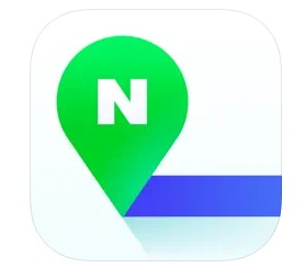
To navigate the streets of the massive concrete jungle that is Seoul, Google Maps may not be the best idea.
A local favorite is Naver Map, operated by Korea's answer to Google, Naver.
The country’s most-used web portal provides some of the most up-to-date information on Korean addresses and routes.
Its map and location services are offered in Korean, English, Chinese and Japanese. By default, it is set to match the language on one’s smartphone, but the user can switch the language by tapping on the three-line menu at the top-left corner and then clicking on the cogwheel icon for settings.
Right beneath the search box at the top are buttons for restaurants, cafes, gas stations, convenience stores and so forth. By tapping each button, you can see which of the corresponding establishments are in the vicinity of your location. You can also move the location on the map to other areas and tap the button to see which restaurants or cafes are in that area.
The app also provides a basic GPS-based navigation system. You can simply set your desired destination by typing it in the search box, select your means of transportation -- public transportation, car, foot or bike -- and it will show you possible routes and the estimated time it would take to get there.
By clicking on each option, you can also see the specific routes on the map.
Seoul Subway
Last month, Seoul subway service operator Seoul Metro launched the English version of its mobile app, Seoul Subway. In addition to a basic map of the Seoul Metropolitan Subway, the rapid transit service for Seoul and its surrounding areas, it also provides real-time data on the current location of each train if you tap on the “real-time” button at the bottom of the page.

The application shows both the fastest and the simplest routes from one point to another, the number of stops and transfers and how much they would cost by either a transit card or cash. It also recommends popular tourist sites around each station, prominent events occurring that day and information on express lines throughout the Greater Seoul area.
The “information” button on the bottom-right section of the page provides the latest news related to the Seoul Metro, fare prices, how to get various types of tickets, emergency contact information -- such as the police, lost and found and embassies of the US and China in Seoul -- and links to other subway-related applications and web pages such as the Ttota locker service and the T-luggage storage and delivery service.


![[Herald Interview] Mistakes turn into blessings in street performance, director says](http://res.heraldm.com/phpwas/restmb_idxmake.php?idx=652&simg=/content/image/2024/04/28/20240428050150_0.jpg&u=20240428174656)